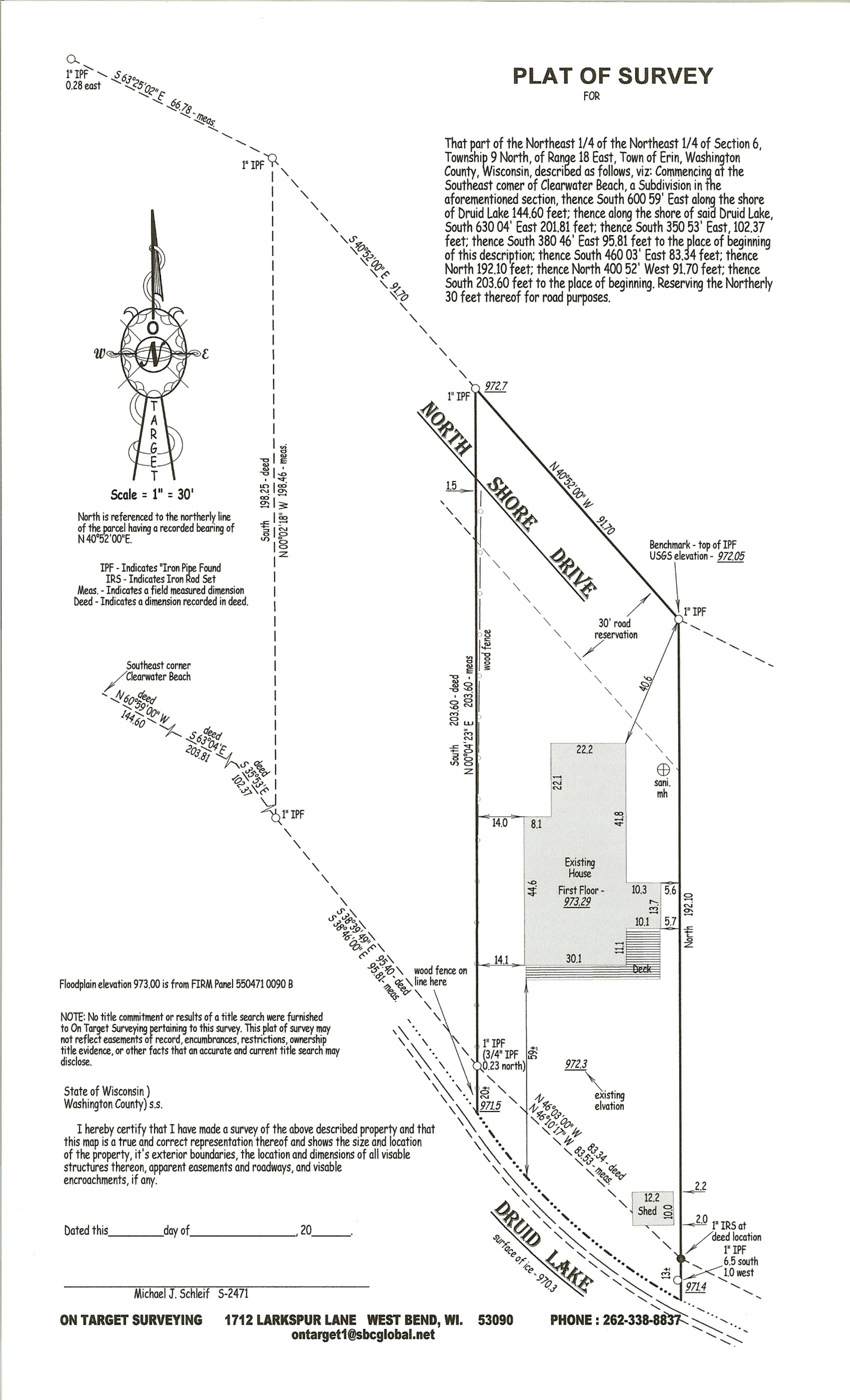
There are many different types of surveys available. The most common is probably a typical boundary survey resulting in a Plat of Survey. This is a survey of an existing parcel of land in order to determine the actual location of the property on the ground. The boundary survey will quite often require the location of many lot corners (iron pipe or rebar) on the parcel surveyed as well as those off the site. The reason for this is to make sure that all lot corners used are in their correct position. The Plat of Survey will show all lot corners set or found, major improvements on the parcel and any easements that might affect the parcel (if a title policy is provided). If the Plat of Survey is to be used for proposed building then the site elevations are added as well as the proposed building staked on the lot with offsets. In either case it is signed, dated and stamped by a professional surveyor. A typical boundary survey would be used to provide lot line locations in order to erect fences, building additions, or any major landscaping projects. Copies of the map are filed with the County Surveyor’s Office.
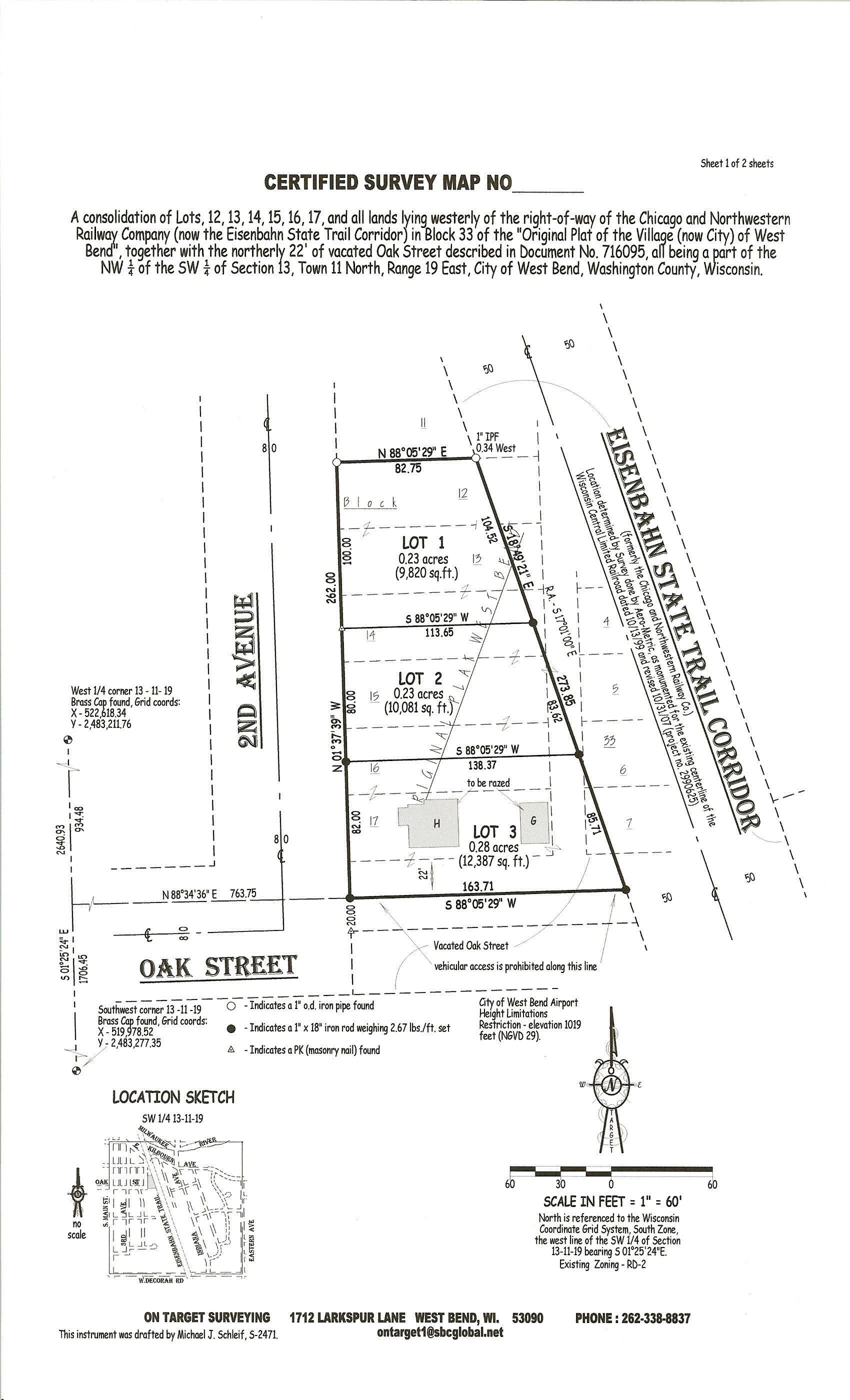
Next we have a Certified Survey Map. While this may get a little confusing as the Plat of Survey is also “certified” the purpose of the Certified Survey Map is much more specific. It is designated by Wisconsin law as a tool to enable a landowner to create up to four lots without using the Platting process, which can become a bit long and involved, as it is basically intended to create subdivisions. In the case of the Certified Survey Map, a total boundary for the parcel is determined in much the same way as the Plat of Survey but then that boundary is divided to show up to four new lots. All lot corners are staked with iron pipe or rebar and the parcel is tied into the Section Line. The map is then “certified” by a professional surveyor, signed and witnessed by the landowner and their Mortgagee and approved by all municipal approving agencies having the authority to do so. It is then recorded with the Register of Deeds for the county involved and the new lots are created.
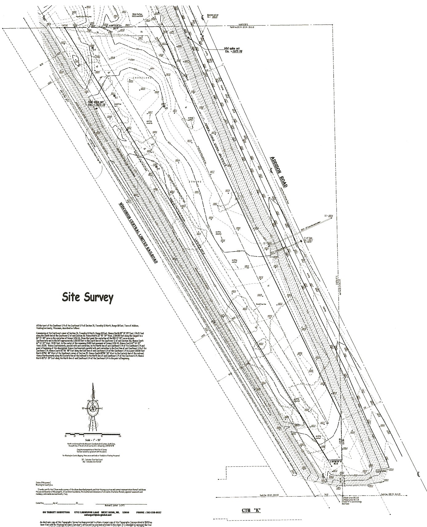
The next commonly used survey would most likely be the Site Survey. In this case the boundary is again determined as the Plat of Survey does, but in addition to that, elevations are taken throughout the parcel as well as locations of high points, low points, curb and gutter, sidewalk, blacktop and any other distinguishable features that affect the site. Contours indicating the actual “lay of the land” are added and spot elevations are shown. The purpose for this type of survey is to prepare a parcel of land for development. This map would become the base map for all proposed changes to the site. It is also filed with the County Surveyor’s Office but copies are generally also provided to engineers to aid in their part of the development.
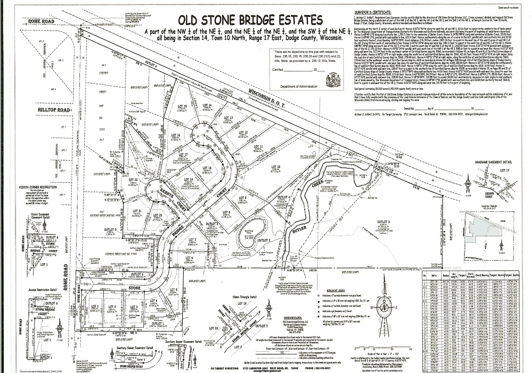
Then would come the Subdivision Plat, which is the document used to create more than four lots. A boundary survey is completed and the lots staked as above. All municipalities involved as well as several State agencies also approve this map. Once staked and approved the map is recorded with the Register of Deeds Office much the same way as the Certified Survey Map.
There are several more types of surveys as well, surveys for lot line disputes, floodplain location, building removal from a floodplain, rezoning issues and elevation determinations.
As well as those mentioned above there are varying surveys offered for construction purposes such as staking roads, sewers and watermain.